Add documentation for dcw collections #17
Comments
|
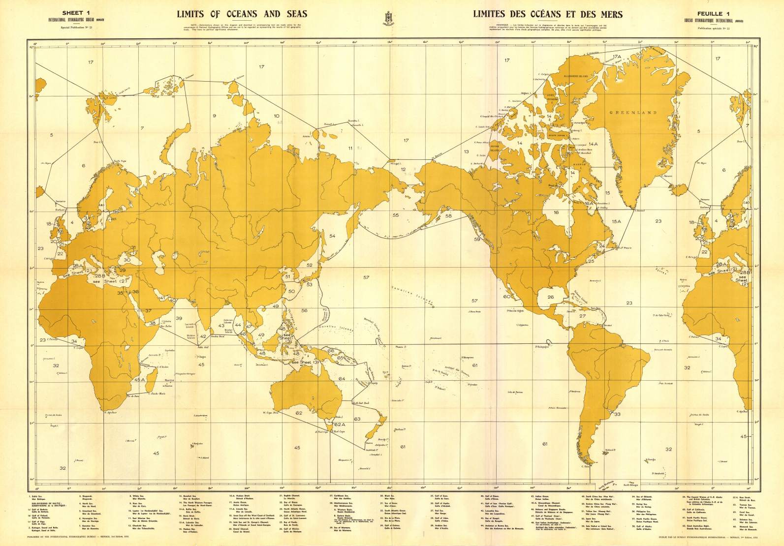
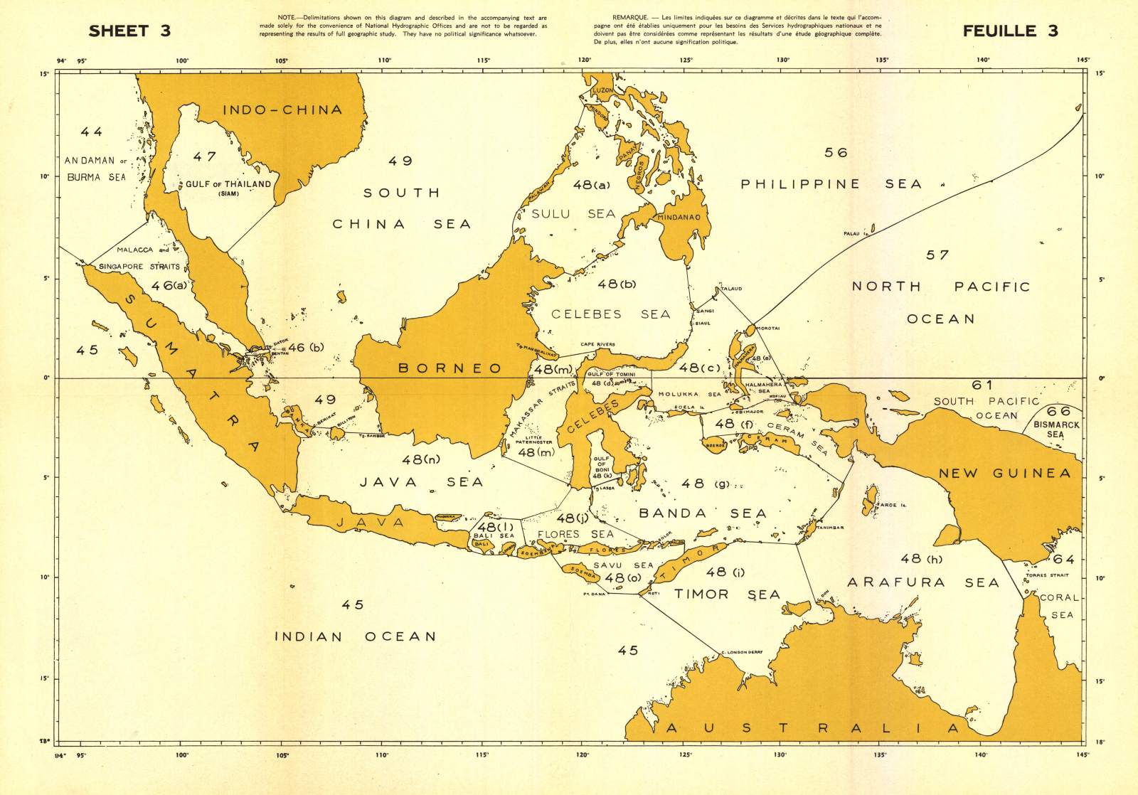
I have been watching the pdfs. I think we shouldn't show all of them. For the Lists of countries (Regiones.pdf) I think we can add a Wikipedia link or show a single map. For example for the UN regions (M49) we can show a single map like this or this Wikipedia page. For the Geographic regions, instead we could show a maps likes these 3 for the IHO seas and oceans (world, Mediterranean, East Indies). For the rest of the regions included in Seas.pdf (lakes, Islands, Archipelagoes), I think there is no need to show a map since it is very straightforward because there is no discussion in the limits (If someone types "- Finally, for the geography regions of the Geography_relief.pdf, I think we can show them. There are only 37 maps/pages (of 244). I could try to reduce them to fit in a small pdf with |
This feature request is to add a section to the remote dataset documentation for DCW including either a link to Federico's PDF files or a table showing the outlines of the regions.
Link to the zip file with the batch scripts for generated pdfs - GenericMappingTools/dcw-gmt#31 (comment)
PDFs of the collections - GenericMappingTools/dcw-gmt#31 (comment)
The text was updated successfully, but these errors were encountered: